150
150
Nov 12, 2012
11/12
by
KOFY
tv
eye 150
favorite 0
quote 0
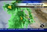
tuesday, part of this front starts to sag a little to the south and san rafael and points north up to ukiah, we could possibly see a few light showers monday night and tuesday. by wednesday, high pressure builds back in and everything pushes back up to the north. clear skies and sunshine and mild temperatures by mid-week. here is a look at highs for monday. temperatures coming up a few more degrees, 62 for san rafael. interior east bay mid to low 60s. san jose you'll warm to 64. even the boardwalk, santa cruz, mild at 65 is sun and clouds and also some sunshine. accu-weather seven-day forecast, tuesday slight chance of showers north of the golden gate bridge. wednesday a terrific day, 60s mild with sunshine and look for more scattered showers and chance of very heavy rain moving in next sunday night through the travel week. >> ama: thank you. shu is here with sports. end of the niners game. >> nobody wanted to leave. 49ers hosting the rams. 49ers lost alex smith due to a concussion. came back to tie it. we'll take it from there. first quarter. rams up by 14. alex smith takes off. instead of
tuesday, part of this front starts to sag a little to the south and san rafael and points north up to ukiah, we could possibly see a few light showers monday night and tuesday. by wednesday, high pressure builds back in and everything pushes back up to the north. clear skies and sunshine and mild temperatures by mid-week. here is a look at highs for monday. temperatures coming up a few more degrees, 62 for san rafael. interior east bay mid to low 60s. san jose you'll warm to 64. even the...
183
183
Nov 28, 2012
11/12
by
KTVU
tv
eye 183
favorite 0
quote 0
rainfall and in the next hour it will start to fall but it is beginning to come up into lake county, ukiah, there will be some pretty good bursts, from marin county, things are picking up, nothing is too heavy yet, but a want to draw your attention. as advertised, this would come in and it is behaving exactly like i thought it would. it will be a moderate or we will have a high wind warning in until 7:00 a.m. >>> what police in gilroy think may have been the motive for that shooting of eight people inside a home. >>> and residents are preparing for a series of storms and we will explain more when news continues. ♪ ...could end with adding a close friend. ♪ the lexus december to remember sales event is on, offering some of our best values of the year. this is the pursuit of perfection. . >>> costco is up 4% this morning. >> well, all right, pam, we will say good morning and thank you for joining us, i am dave clark. >> good morning, thank you for joining us, time now 6:30. >> we are on storm watch, strong winds and it is the first of several storms moving into the bay area right now. we
rainfall and in the next hour it will start to fall but it is beginning to come up into lake county, ukiah, there will be some pretty good bursts, from marin county, things are picking up, nothing is too heavy yet, but a want to draw your attention. as advertised, this would come in and it is behaving exactly like i thought it would. it will be a moderate or we will have a high wind warning in until 7:00 a.m. >>> what police in gilroy think may have been the motive for that shooting of...
141
141
Nov 23, 2012
11/12
by
KGO
tv
eye 141
favorite 0
quote 0
it doesn't even feel like late november. 67 in san francisco, half moon bay. 65 degrees up to ukiah. you'll see the high clouds out for the afternoon but it is looking gorgeous. monterey bay, above average temperatures, 72 in santa cruz, 74 for watsonville. hollister, 76 degrees. accu-weather seven-day forecast, sunny and mild pattern for friday, saturday and mid-60s to low 70s. sunday it will turn a little cooler as the system passes to our north. we'll keep the rain out of the forecast. just a little cooler each and every day. wednesday late in the day, a chance of some rain. you'll notice the temperature falling upper 50s to low 60s. by thursday it is going to become wet across the entire bay area. as i mentioned, bargain hunters, getting out tomorrow morning, you'll find a deal weather-wise. i know carolyn is going to be out there. make sure you have layers especially in the valleys. >> we're so glad you are feeling better. thank you so much. >> coming up the reason behind today's partial closure of a popular local b >>> california highway patrol vehicle ended up on the right rai
it doesn't even feel like late november. 67 in san francisco, half moon bay. 65 degrees up to ukiah. you'll see the high clouds out for the afternoon but it is looking gorgeous. monterey bay, above average temperatures, 72 in santa cruz, 74 for watsonville. hollister, 76 degrees. accu-weather seven-day forecast, sunny and mild pattern for friday, saturday and mid-60s to low 70s. sunday it will turn a little cooler as the system passes to our north. we'll keep the rain out of the forecast. just...
190
190
Nov 12, 2012
11/12
by
KRON
tv
eye 190
favorite 0
quote 0
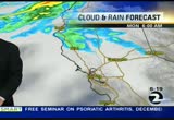
note that we have some showers showing up on the north coast even around ukiah right now but this system is really going to struggle to make it to the south. it's going to try but break up by the time it gets here so we'll see some clouds and, again, on tuesday, maybe a sprinkle sonoma county. here's future cast. midnight tonight, note all of the rain is here, but we do see some clouds stretching into the bay area and that's going to be the case as we go into monday and tuesday, as well. so the bulk of that storm, all of the rain staying to the north, mendocino and into counties on the north coast. tonight's temperatures look for readings close to freezing here in the north bay as well as the east bay. mid to upper 30s with 40s by the bay, and highs for the afternoon, not too bad. low to mid 60s with mostly sunny skies, fremont, santa clara, evergreen, low to mid 60s. we'll be up to 63 greece in pittsburgh, 64 don cord, dan vishlgs look for low 60s by the bay. san francisco even in the 65s. santa rosa, 62. here's a look ahead at the 7-day around the bachlt tuesday increased cloud cover.
note that we have some showers showing up on the north coast even around ukiah right now but this system is really going to struggle to make it to the south. it's going to try but break up by the time it gets here so we'll see some clouds and, again, on tuesday, maybe a sprinkle sonoma county. here's future cast. midnight tonight, note all of the rain is here, but we do see some clouds stretching into the bay area and that's going to be the case as we go into monday and tuesday, as well. so the...
145
145
Nov 19, 2012
11/12
by
KTVU
tv
eye 145
favorite 0
quote 0
everyone up toward ukiah and clearlake. not much changes until this front makes its move on tuesday. it will take awhile to get here. by tuesday night it will make its move. and then late tuesday night over night into early wednesday. there it is. around midnight tomorrow night and by 6:00 a.m. i think wednesday most of this is out of the picture. you can say goodbye. pattern will be changing. clouds, sun, mild cloudy to the north. maybe light rain if you are traveling up that way. 60s on the temps. a little warmer toward morgan hill and gilroy. clouds, rain, coming on tuesday night into early wednesday. then it's out of here. thursday looks good. friday the weekend looks good. >>> thank you, steve. we are following breaking news just into our newsroom right now. intel has announced that ceo paul plans to retire in may. the stock is now halted this morning on the news. that is typical procedure when there is a big management change like that for ceo imparticular. i want to check in on the stalk. right now it looks like it w
everyone up toward ukiah and clearlake. not much changes until this front makes its move on tuesday. it will take awhile to get here. by tuesday night it will make its move. and then late tuesday night over night into early wednesday. there it is. around midnight tomorrow night and by 6:00 a.m. i think wednesday most of this is out of the picture. you can say goodbye. pattern will be changing. clouds, sun, mild cloudy to the north. maybe light rain if you are traveling up that way. 60s on the...
198
198
Nov 18, 2012
11/12
by
KGO
tv
eye 198
favorite 0
quote 0
the rain starting to move in through the ukiah area. looking closer, you can see yellows with the heavy rain that's starting a little pocket of heavy rain to the east. clayton road picking up that moderate rain, and starting to pick up a little pocket of moisture from novato, san rafael. and wood acres, so all of this is going to continue to slide south overnight tonight so we'll continue with rain and wind joafs night. a few lingering showers tomorrow morning, and then look for afternoon sunshine for your sunday. a dry day for our monday. here's a look at the actual cold front. you can see it as it -- just kind of squeezing in here. this is actually the back edge here. to give you a sense, this ths thing is barreling through in the next couple off -- couple of hours, we'll see most of the front move through the north bay. half moon bay. you may encounter pockets of mod rat rain. gusts up close to 57 miles-per-hour. the rain pushes to the south tonight. santa rosa, ukiah, a fast mover, we may even see some partial clergy there. 2:00 a.m
the rain starting to move in through the ukiah area. looking closer, you can see yellows with the heavy rain that's starting a little pocket of heavy rain to the east. clayton road picking up that moderate rain, and starting to pick up a little pocket of moisture from novato, san rafael. and wood acres, so all of this is going to continue to slide south overnight tonight so we'll continue with rain and wind joafs night. a few lingering showers tomorrow morning, and then look for afternoon...
248
248
Nov 29, 2012
11/12
by
KGO
tv
eye 248
favorite 0
quote 0
., it begins to move in across the coastal areas, the heaviest rain is focused in ukiah. that's not where the focus will remain. i will be back with a closer look at that storm, and it will dump some heavy rainfall. impressive totals coming up in a few minutes. carolyn? >> thank you. the brunt of the storm swept through before noon. despite the warnings it still caught some people off guard. alan wang is live where one couple almost ground. almost drowned. alan? >> carolyn, the santa rosa creek is behind me and we are told a number of homeless people live along its banks. when the storms come the waters can rise and fall quickly, and today two people and their dog found out the hard way in santa rosa an inch of rain fell before 10:00 a.m. it rushed through the creek where a homeless couple and their dog were taking shelter in this culvert. >> they were violently pushed out of the culvert. >> he were swept into the -- they were swept into the water and suffered exposure and cuts. firecrews are bracing for more trouble as we head into the weekend. >> the national weather se
., it begins to move in across the coastal areas, the heaviest rain is focused in ukiah. that's not where the focus will remain. i will be back with a closer look at that storm, and it will dump some heavy rainfall. impressive totals coming up in a few minutes. carolyn? >> thank you. the brunt of the storm swept through before noon. despite the warnings it still caught some people off guard. alan wang is live where one couple almost ground. almost drowned. alan? >> carolyn, the...
227
227
Nov 12, 2012
11/12
by
KTVU
tv
eye 227
favorite 0
quote 0
main hi up to our north from ukiah to the north. so we'll pick up a fi high clouds targeting the north bay and a chance of a few rain showers in mendocino to humboldt county. then into tuesday morning there is the rain line primarily to the north and pretty much the same deal into wednesday. now by friday, we could be track a few light rain showers, but at this point, it is still just a chance. forecast highs after that chilly start tomorrow morning, and nice recovery into the afternoon. lots of 60s. so these numbers in most areas, a little bit warmer than today, oakland 62, livermore, 63 degrees and danville, 63. some more neighborhoods san josi right around 64. light of upper 50s coast side. a look ahead, your five-day forecast. you will notice the temperatures come up for the overnight lows. so not as cold tuesday morning. once again we'll see a few extra high clouds in the north bay. at this point we're trying to figure out some of the forecast models hinting at a few models. we don't have a perfect idea, but the at least at thi
main hi up to our north from ukiah to the north. so we'll pick up a fi high clouds targeting the north bay and a chance of a few rain showers in mendocino to humboldt county. then into tuesday morning there is the rain line primarily to the north and pretty much the same deal into wednesday. now by friday, we could be track a few light rain showers, but at this point, it is still just a chance. forecast highs after that chilly start tomorrow morning, and nice recovery into the afternoon. lots...
107
107
Nov 22, 2012
11/12
by
KGO
tv
eye 107
favorite 0
quote 0
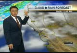
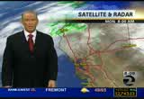
ukiah is just a little bit below where you should be. here is the forecast, clear and chilly overnight. patches of fog for the interior valleys and look for sunny and mild weather for thanksgiving. tomorrow morning if you have early plans to travel, watch out for the fog in the valleys. temperatures will be running low. it will be cold. make sure you bundle yourselves up. the temperatures will be in the upper 30s around fairfield. 37 napa and 37 santa rosa. most other areas will be in the 40s except san francisco down to 50 degrees. here is a look at the satellite and the radar. the cold front that came through brought us the rain. it is long gone. now the high pressure starts to push the storm track to the north. that just means a dry pattern heading into next week. overnight we are already seeing some fog in the sacramento valley. some is going to start to spill over toward the bay area. so the valley fog expands this weekend. could be dense in pockets like it normally is this time of year. watch out for that. tomorrow afternoon is loo
ukiah is just a little bit below where you should be. here is the forecast, clear and chilly overnight. patches of fog for the interior valleys and look for sunny and mild weather for thanksgiving. tomorrow morning if you have early plans to travel, watch out for the fog in the valleys. temperatures will be running low. it will be cold. make sure you bundle yourselves up. the temperatures will be in the upper 30s around fairfield. 37 napa and 37 santa rosa. most other areas will be in the 40s...
173
173
Nov 12, 2012
11/12
by
KRON
tv
eye 173
favorite 0
quote 0
and by tuesday, we could see some sprinkles maybe some showers to santa rosa, to ukiah. tonight's temperatures will be decent. with a little warmer tomorrow. and that is pretty much where we will be for the brest of the bay area. and also for the north bay. san francisco, 61 degrees and as we take a look ahead for tuesday. partly cloudy skies it sunshine toward the sprinkles, no. as i mentioned. some areas around 70 degrees. and some rainfall possibly thursday/friday. >> tonight, a candlelight vigil was being held in a memory of the 19 year-old man found dead in the the bandit hayward building earlier this week. police found the body of ernesto calleros inside an empty car repair shop on mission boulevard to stay night. authorities say the body appeared to have been there for quite some time. his family is asking for anybody with information to come forward. >> this is shocking. he was very loyal to his family and girlfriend. >> his missing was reported by his father november 1st. police have to release the cause of the death but his home near folsom, and no revenue is w
and by tuesday, we could see some sprinkles maybe some showers to santa rosa, to ukiah. tonight's temperatures will be decent. with a little warmer tomorrow. and that is pretty much where we will be for the brest of the bay area. and also for the north bay. san francisco, 61 degrees and as we take a look ahead for tuesday. partly cloudy skies it sunshine toward the sprinkles, no. as i mentioned. some areas around 70 degrees. and some rainfall possibly thursday/friday. >> tonight, a...
200
200
Nov 23, 2012
11/12
by
KTVU
tv
eye 200
favorite 0
quote 0
i mean even from stinson beach up to ukiah and clearlake. pittsburgh in there. all within a degree or two of each other. 70 in gilroy. close for mor ban hill. 66 woodside. 67 for menlo park. nice on the coast. looks good on saturday into sunday as well. a little cooler on monday. increasing clouds on tuesday. >>> new legal problems for a controversial comedian who recently performed in oakland. why fans of cat williams are signing up for a class action lawsuit. >>> a firefighter is hospitalized and 18 people without homes in san jose. we'll have the latest on the investigation. >>> here's a look at the san mateo bridge on this beautiful black friday morning. and we do have an incident to report on the peninsula. we'll tell you about that coming up. i'm going to dream about that tiramisu. what a night, huh? but, um, can the test drive be over now? head back to the dealership? [ male announcer ] it's practically yours. but we still need your signature. volkswagen sign then drive is back. and it's never been easier to get a passat. that's the power of german engine
i mean even from stinson beach up to ukiah and clearlake. pittsburgh in there. all within a degree or two of each other. 70 in gilroy. close for mor ban hill. 66 woodside. 67 for menlo park. nice on the coast. looks good on saturday into sunday as well. a little cooler on monday. increasing clouds on tuesday. >>> new legal problems for a controversial comedian who recently performed in oakland. why fans of cat williams are signing up for a class action lawsuit. >>> a...
131
131
Nov 28, 2012
11/12
by
KTVU
tv
eye 131
favorite 0
quote 0
everything is offshore poised to move in and today it is widespread, it will rain all the way from ukiah and santa cruz and it looks like a fast mover. we will focus our attention on the north bay and again the santa cruz mountains, saturday it takes more aim at that. it is possible we could see 10 to 8 more inches. cape mendocino north, there will still be a lot of systems and now it is becoming one and it will move on shore and as long as it keeps marching, it will take aim at the marin coast. also the rushing river area, things are beginning to start nothing too heavy but it will pick up around 7:00, 8:00 or 9:00. also in mendocino, and lake county and down to santa cruz and monterey it will be a rainy morning. it is not too heavy yet but it is on its way. when you see darker green rain begins to pick up and that will not come in for another couple of hours but it is a sign of things to come. the rain will pick up and the high wind warnings have been posted. high gusts in some of the higher elevations. rain and wind, morning rain gives way to a blustery day and there will be a distinc
everything is offshore poised to move in and today it is widespread, it will rain all the way from ukiah and santa cruz and it looks like a fast mover. we will focus our attention on the north bay and again the santa cruz mountains, saturday it takes more aim at that. it is possible we could see 10 to 8 more inches. cape mendocino north, there will still be a lot of systems and now it is becoming one and it will move on shore and as long as it keeps marching, it will take aim at the marin...
150
150
Nov 22, 2012
11/12
by
KGO
tv
eye 150
favorite 0
quote 0
ukiah is just a little bit below where you should be. here is the forecast, clear and chilly overnight. patches of fog for the interior valleys and look for sunny and mild weather for thanksgiving. tomorrow morning if you have early plans to travel, watch out for the fog in the valleys. temperatures will be running low. it will be cold. make sure you bundle yourselves up. the temperatures will be in the upper 30s around fairfield. 37 napa and 37 santa rosa. most other areas will be in the 40s except san francisco down to 50 degrees. here is a look at the satellite and the radar. the cold front that came through brought us the rain. it is long gone. now the high pressure starts to push theto the storm track te north. that just means a dry pattern heading into next week. overnight we are already seeing some fog in the sacramento valley. some is going to start to spill over toward the bay area. so the valley fog expands this weekend. could be dense in pockets like it normally is this time of year. watch out for that. tomorrow afternoon is l
ukiah is just a little bit below where you should be. here is the forecast, clear and chilly overnight. patches of fog for the interior valleys and look for sunny and mild weather for thanksgiving. tomorrow morning if you have early plans to travel, watch out for the fog in the valleys. temperatures will be running low. it will be cold. make sure you bundle yourselves up. the temperatures will be in the upper 30s around fairfield. 37 napa and 37 santa rosa. most other areas will be in the 40s...
194
194
Nov 19, 2012
11/12
by
KTVU
tv
eye 194
favorite 0
quote 0
ukiah. there's been some light drizzle. it's up there, that system but it's waiting to come back here until torm. some areas will have a lot of snub -- a lot of sun. other areas will be dealing with a lot of cloud cover. clouds increase on seuss and -- tuesday and then the -- clouds increase and then the rain will pick up. cloudy to north. more sun to the south. that means temperatures up for some. a little cooler for others. not a bad day overall. 6s on on the temperatures -- 60sen the temperatures -- 60s on the temperatures. upper 60s in gilroy. clouds increase on tuesday. we'll bring rain in. it looks like a decent system north bay -- it looks like a decent system in the north bay. that will really be forming. some areas will have a lot of sunshine. warmer temperatures. >>> a big vote tomorrow in san francisco on whether to band public nudity. the proposed ordinance would make nudity illegal with the exception of street fairs that have permits and parades. scott evener -- scott wiener is pushing the issue. a group of nud
ukiah. there's been some light drizzle. it's up there, that system but it's waiting to come back here until torm. some areas will have a lot of snub -- a lot of sun. other areas will be dealing with a lot of cloud cover. clouds increase on seuss and -- tuesday and then the -- clouds increase and then the rain will pick up. cloudy to north. more sun to the south. that means temperatures up for some. a little cooler for others. not a bad day overall. 6s on on the temperatures -- 60sen the...
168
168
Nov 19, 2012
11/12
by
KTVU
tv
eye 168
favorite 0
quote 0
but up toward fort bragg, ukiah you can get a few light showers. you can see that is the trend today. this will work its way toward us. but it's not going to be about until 36 hours. one more system then it looks like the pattern will change as we do into thanksgiving and probably the next 5-7 days. we'll have to deal with this system coming in. it doesn't look like a big system but it will give rain to the north bay than anybody else. clouds and sun on the mild side. a little cool out there. cloudy to the north. a little bit more sun to the south. and temperatures 60s farther south. . mostly cloudy tuesday rain develops. takes us into wednesday morning. clouds will be deep. kind of getting out of the area. boot scooting away. and we go mostly clear. starting to look like fog. dave and pam. >>> new questions about whether america's cup is pushing speed limits too far. what racing officials are rethinking in the wake of oracle team's crash on the bay. >>> look at that. something just blew up. >> new video of that deadly oil rig explosion in the gulf
but up toward fort bragg, ukiah you can get a few light showers. you can see that is the trend today. this will work its way toward us. but it's not going to be about until 36 hours. one more system then it looks like the pattern will change as we do into thanksgiving and probably the next 5-7 days. we'll have to deal with this system coming in. it doesn't look like a big system but it will give rain to the north bay than anybody else. clouds and sun on the mild side. a little cool out there....
44
44
Nov 12, 2012
11/12
by
KNTV
tv
eye 44
favorite 0
quote 0
this is video from september's wildfire in lake county near ukiah. that fire burned more than seven square miles. >>> meteorologist christina loren joins is right now from the nbc bay area weather center. another cold start to the morning. >> yeah, it is cold. that's really great news about fire season being called. always a good idea to be on the best of fire safety, as we do have quite a bit of trees around here and it can get dangerous, even this time of year. you probably noticed that, probably had to apply the chapstick over the weekend. 42 degrees in sonoma, 36 in livermore and 42 in san jose. so the difference between yesterday morning and this morning is our relative humidities have crept up just enough for us to warm up a few degrees. it's not as frigid as the past couple of days but still cold enough for a heavy winter coat. one of the things that lead to frost, clear skies and calm winds. so you might find some frost on your windshield. wind out of the east at 3 miles per hour in livermore. later on today you'll be at about 65 there, 64 in
this is video from september's wildfire in lake county near ukiah. that fire burned more than seven square miles. >>> meteorologist christina loren joins is right now from the nbc bay area weather center. another cold start to the morning. >> yeah, it is cold. that's really great news about fire season being called. always a good idea to be on the best of fire safety, as we do have quite a bit of trees around here and it can get dangerous, even this time of year. you probably...
123
123
Nov 29, 2012
11/12
by
KGO
tv
eye 123
favorite 0
quote 0
light showers this morning, live doppler showing most activity in the north bay up through cloverdale, ukiah, a few showers offshore also napa and snow may. if you are headed out highway 101 and 121 on the wet side, be careful, give yourself extra time visibility not a problem temperatures are mild, 50 redwood city, 58 mountain view, 53 concord as well as fairfield, 57 at our coast. here's the forecast, a few showers mainly north bay chance of showers every else today, the main rain going to hold off towards the latter part of the evening commute into the overnight hours and tomorrow. this is storm number two that is going to bring heavier rain first north but it is sinking south not much of a break for the next system to head our way saturday into sunday high temperatures ranging on the mild side each and everyday winds picking up later on tonight. once again a little break today. >>> good morning. thursday, light out there now. first live check of the bay bridge toll, no problems, metering lights off, no issues, except high winds on the bridges around the bay area again this morning. take
light showers this morning, live doppler showing most activity in the north bay up through cloverdale, ukiah, a few showers offshore also napa and snow may. if you are headed out highway 101 and 121 on the wet side, be careful, give yourself extra time visibility not a problem temperatures are mild, 50 redwood city, 58 mountain view, 53 concord as well as fairfield, 57 at our coast. here's the forecast, a few showers mainly north bay chance of showers every else today, the main rain going to...
167
167
Nov 6, 2012
11/12
by
KTVU
tv
eye 167
favorite 0
quote 0
you get 80 degrees, and yesterday we had that, record highs from redding and ukiah, 15 around here to. without the breeze, i mean it's really tough for antioch to warm up. some areas are in the 40s unless there is a howling offshore breeze. sunny nice to warm, not as warm as yesterday, cooling trends goes from 70s to 80s and high 50s. there will be some rain, chilly lows as you just saw some of those 40s. 70s on temperatures, a few in red wood city. temperatures are really warm today. here comes some cloud showers, cold conditions taking it right into your weekend, it will be cold by sunday. >>> it slipped during the third quarter, and apple still has a solid lead over its competitors. >> it is 18 with total sales and kendall is third with 9%. >>> the flight is about a high functioning alcoholic and they want them to obscure or remove the budweiser picture from the film. they typically pay their companies but anheuser busch was never contacted. >>> oracle team is bouncing back from last month's boating accident and we will have more on what they are doing with the damaged parts. >>> p
you get 80 degrees, and yesterday we had that, record highs from redding and ukiah, 15 around here to. without the breeze, i mean it's really tough for antioch to warm up. some areas are in the 40s unless there is a howling offshore breeze. sunny nice to warm, not as warm as yesterday, cooling trends goes from 70s to 80s and high 50s. there will be some rain, chilly lows as you just saw some of those 40s. 70s on temperatures, a few in red wood city. temperatures are really warm today. here...
190
190
Nov 20, 2012
11/12
by
KTVU
tv
eye 190
favorite 0
quote 0
ukiah has had 2 lights. it looks like it's pushing off to the east bay. but even down in the santa cruz mountains we have had a couple of reports. there it is. again, it looks like it's been a real impact -- it's been a real compact system. heavy rain up there as well even up into extreme northern part of california. this system is packing a pretty good punch here. it is on its way. the light rain out ahead of it. some of it should taper out. cloudy to mostly cloudy, very windy in advance of the wind. north bay mainly picking up the rain. we've had a couple of .100ths. windy, cloudy, coming in tonight and then the rain rate will pick up. i think there will be a couple of inches of rain in lesser amounts as you go south. now for the sierra, winter weather advisory is at 4:00. rain will turn to snow overnight. snow will come down to 6,000. cloudy, windy, rain developing already pretty steady to the north. for everybody later on. 60s on the temperatures or upper 50s. i think there's too much in the of -- in the way of rain. 70, morgan hill and gilroy. we hav
ukiah has had 2 lights. it looks like it's pushing off to the east bay. but even down in the santa cruz mountains we have had a couple of reports. there it is. again, it looks like it's been a real impact -- it's been a real compact system. heavy rain up there as well even up into extreme northern part of california. this system is packing a pretty good punch here. it is on its way. the light rain out ahead of it. some of it should taper out. cloudy to mostly cloudy, very windy in advance of...
155
155
Nov 9, 2012
11/12
by
KOFY
tv
eye 155
favorite 0
quote 0
now to the north just around the mostly clear lake area south of ukiah. the pink on live doppler 7 hd mixed precipitation and rain and snow. under a winter weather advisory as they have already seen accumulating snow down to 2500 feet. here's a loop of the radar here. live doppler 7 hd and you will notice the lightning strike we have seen several lightning strike a good one 40 miles off the coast. not materializing yet but still potential for thunderstorms in the forecast through tomorrow. chain control heading to tahoe on all major routes. it's still snowing and they are going to be counting up to the a foot when all said and done. rainfall total it has been on the light side but you may have run in a brief downpour here and there. san francisco 18 hundredths of an inch. santa rosa/100ths of an inch. 4 hundredths in oakland. trace in san jose. and livermor livermore/100ths of an inch. here's what is coming temperatures are dropping. getting cold. low 40's around santa rose. mid 40's in nap. half man bay bundle up stay warm tonight. scattered showers thro
now to the north just around the mostly clear lake area south of ukiah. the pink on live doppler 7 hd mixed precipitation and rain and snow. under a winter weather advisory as they have already seen accumulating snow down to 2500 feet. here's a loop of the radar here. live doppler 7 hd and you will notice the lightning strike we have seen several lightning strike a good one 40 miles off the coast. not materializing yet but still potential for thunderstorms in the forecast through tomorrow....
119
119
Nov 6, 2012
11/12
by
KTVU
tv
eye 119
favorite 0
quote 0
nice to warm yesterday, we had a bunch, just a bunch, 84 santa rosa, even redding, stockton ukiah was a record. >> 70s and 80s, santa rosa, i doesn't think so. that will not happen, san francisco 76 and that record is 83. oakland could be close, 80 is going 78, san jose will be right in there. redwood city as well. there needs to be a couple 49 in antioch, the warmest temperatures are on the coast and there is a little component on the coast. there in lice the problem, it will still be nice but it will be sunny and warm for november. temperatures are topped out and it will be cold by friday. chilly lows inland. highs will be on the upper -- in the upper 70s for many. it is tough to get the inland lows to warm up. it definitely helps the coast. here comes that system and our temperatures will go way down. >>> it's just a week after being devastated by that super storm. the storm that is bearing down on them and how the jersey shore is preparing. >>> plus a possible new tool to combat metropolitan abuse, how it works and where it's being tested right now. >>> it is a problem but we will
nice to warm yesterday, we had a bunch, just a bunch, 84 santa rosa, even redding, stockton ukiah was a record. >> 70s and 80s, santa rosa, i doesn't think so. that will not happen, san francisco 76 and that record is 83. oakland could be close, 80 is going 78, san jose will be right in there. redwood city as well. there needs to be a couple 49 in antioch, the warmest temperatures are on the coast and there is a little component on the coast. there in lice the problem, it will still be...
174
174
Nov 12, 2012
11/12
by
KTVU
tv
eye 174
favorite 0
quote 0
ukiah, fort brag never makes it south. in fact, as the next system comes in, by mid-week we will be near 70 degrees. a cold morning, no doubt, 50s and 60s, everybody will be on the same page here. 60s, low-to-mid, not much of a difference. although santa cruz will be the warmest at 67 degrees. wednesday and thursday, increasing clouds, most likely the system waits until sunday and monday. >>> 5:07 is the time, an incredible story for him and what may lead to the north. also we will be right back. >>> good morning, northbound 101, that traffic looks good, we will tell you more straight ahead. ♪ [ female announcer ] nature exists on the grandest scale... ♪ ...and in the tiniest details. ♪ and sometimes both. nature valley granola thins pack the big taste of granola and dark chocolate into one perfect square, under 100 calories. nature valley granola thins. nature at its most delicious. . >>> we have been checking bridges around, so far so good as you cross the bay. >>> election news is continuing because the race for t
ukiah, fort brag never makes it south. in fact, as the next system comes in, by mid-week we will be near 70 degrees. a cold morning, no doubt, 50s and 60s, everybody will be on the same page here. 60s, low-to-mid, not much of a difference. although santa cruz will be the warmest at 67 degrees. wednesday and thursday, increasing clouds, most likely the system waits until sunday and monday. >>> 5:07 is the time, an incredible story for him and what may lead to the north. also we will be...
147
147
Nov 28, 2012
11/12
by
KTVU
tv
eye 147
favorite 0
quote 0
there will be moderate to heavy rain and it will not be selective and it will be all the way from ukiah to santa cruz, santa clara valley as well. we will give way to afternoon showers and there will be a distinct rain and then a break. that will come in and until thursday night, we will carry that into friday and a stronger system may take more of a focus on the santa cruz mountains. >>> plymouth county, some other residents are concerned. crews removed trees created by the chips fire all in preparation for today's expected heavy rainfall. people on the canyon, other predict the river will rise and don't think mudslides are likely. >>> coming up next, dangerous times for people without a job. how the fiscal cliff could affect long time benefits right here in california. >>> plus the rain started falling, and the traffic troubled spots where the storm is right now. we are storm watch, stay with us.
there will be moderate to heavy rain and it will not be selective and it will be all the way from ukiah to santa cruz, santa clara valley as well. we will give way to afternoon showers and there will be a distinct rain and then a break. that will come in and until thursday night, we will carry that into friday and a stronger system may take more of a focus on the santa cruz mountains. >>> plymouth county, some other residents are concerned. crews removed trees created by the chips fire...
207
207
Nov 13, 2012
11/12
by
KRON
tv
eye 207
favorite 0
quote 0
the satellite and radar showing that we can see that cloud coverage throughout ukiah. and some of that will press into the north bay by midnight. tomorrow, the rain will stay well to the north of the cloud coverage will continue down towards the south. has to go for later as we go-for later, will add up seeing clear skies. and more cloud coverage in place week will seek slightly warmer temperatures for the north bay. and widespread 30's how for the inland valleys, some of these areas could see partial clouds with cooler in livermore, concord and fairfield court and also for the bayshore. temperatures will see mainly warmers in the south bay. '70s in cupertino, 70's in san jose and for the inland valleys still warm. 66 degrees in concord, livermore and the 60s for the east bayshore. the same along the coast toward with temperatures in the low mid-60s even upper 60s for portions of the north bay. a wide range of temperatures but as we get that rainfall on friday it will last for saturday with a series of systems for she towards the weakest fifth. >> the samsung and freud
the satellite and radar showing that we can see that cloud coverage throughout ukiah. and some of that will press into the north bay by midnight. tomorrow, the rain will stay well to the north of the cloud coverage will continue down towards the south. has to go for later as we go-for later, will add up seeing clear skies. and more cloud coverage in place week will seek slightly warmer temperatures for the north bay. and widespread 30's how for the inland valleys, some of these areas could see...
184
184
tv
eye 184
favorite 0
quote 0
thursday we will start to see a few sprinkles developing around ukiah. at 10:00 a.m., the cold front starts to bring in the rain to the north bay. it is not a lot. generally speaking less than a quarter of an inch. santa cruz mountains getting wet. we will see scattered showers on thursday night and then friday morning a thunderstorm possibility at 3:00 a.m. across the heart of the bay area. and we are looking at the possibility of snow mixing in on top of mount hamilton with some rain. that will be during the morning commute on friday. tomorrow it is looking fine. if you have travel plans thursday through fry darks winter -- winter weather advisory. the snow level really dropping to 3,000 feet. wind econ decisions creating blowing snow. carry your chains if you will brave the weather there. tomorrow afternoon, much cooler. low 60s to the low 70s. we will see the fog and low clouds and some higher clouds around for the monterey bay. 62 in monterey. the accu-weather seven-day forecast featuring major changes cold shower thursday. morning thunder possible
thursday we will start to see a few sprinkles developing around ukiah. at 10:00 a.m., the cold front starts to bring in the rain to the north bay. it is not a lot. generally speaking less than a quarter of an inch. santa cruz mountains getting wet. we will see scattered showers on thursday night and then friday morning a thunderstorm possibility at 3:00 a.m. across the heart of the bay area. and we are looking at the possibility of snow mixing in on top of mount hamilton with some rain. that...
196
196
Nov 12, 2012
11/12
by
KTVU
tv
eye 196
favorite 0
quote 0
around ukiah. fort bragg, waiting, waiting, waiting. a stronger system will drop in and then therein lies the rub. it looks -- it looks like a quiet week. high clouds, can't get away from the 30s. days are very short. low 60s for many. i did go 67 in santa cruz. that would be the warmest gilroy not far away. redwood city, 63 after the 58 yesterday. upper 50s to near 60s dan dash here comes the system for friday. i don't think it will do much. but maybe it will give us clouds and rain over the weekend. >>> haven't nis, italy -- venice, italy, the city's high tide mark is at its sixth highest level in 150 years. about 70% of central venice is under water and in tuscany, 200 people have been forced to evacuate from their homes. flooding has collapsed bridges and despited -- destroyed vineyards. >>> look at my yak in placer -- nyak in placer county. chains are required. the north star and heavenly are set to open on friday. bore rial is open -- borrial is open now. >>> a rare bit of good economic news out from europe today. >>> also, when w
around ukiah. fort bragg, waiting, waiting, waiting. a stronger system will drop in and then therein lies the rub. it looks -- it looks like a quiet week. high clouds, can't get away from the 30s. days are very short. low 60s for many. i did go 67 in santa cruz. that would be the warmest gilroy not far away. redwood city, 63 after the 58 yesterday. upper 50s to near 60s dan dash here comes the system for friday. i don't think it will do much. but maybe it will give us clouds and rain over the...
133
133
Nov 2, 2012
11/12
by
KTVU
tv
eye 133
favorite 0
quote 0
look at the rain line maybe ukiah north i would say maybe. mostly sunny, partly cloudy to the north. mild temps. 60s to low, low 70s. and than high pressure says i think i'll come in for that. set your clocks back one hour sunday and enjoy the sunny warm weather. >>> european investors seem to be waiting for the u.s. jobs report for october comes out in just about ten minutes. the major market index is there are mixed right now. overnight nearly all the asian markets closed with gains. hong kong, japan, and south korea all finished the day up more than 1%. investor there is encouraged by signs the global recovery is stabilizing especially in china and the u.s.. checking in on our numbers little of the mixed picture for the futures as well. again the jobs report this is a final one before the presidential election and it is supposed to be pivotal in that election. the dow and nasdaq and s & p posted gains. but again about ten minutes will determine which direction we head today. >>> time now 5:20. now he has an extra $4 billion. what movie leg
look at the rain line maybe ukiah north i would say maybe. mostly sunny, partly cloudy to the north. mild temps. 60s to low, low 70s. and than high pressure says i think i'll come in for that. set your clocks back one hour sunday and enjoy the sunny warm weather. >>> european investors seem to be waiting for the u.s. jobs report for october comes out in just about ten minutes. the major market index is there are mixed right now. overnight nearly all the asian markets closed with gains....
168
168
Nov 7, 2012
11/12
by
KTVU
tv
eye 168
favorite 0
quote 0
going through ukiah and the bay area by tonight and watch what happens in upstream. you can see that gets closer. that will be us by friday. it's on its way. there is not a lot. we'll get some off and on rain as we head toward friday. fog, sun, cooler. a westerly wind. fog on the coast. 70s on the temps today or 60s santa cruz. 72 mountain view. san jose 73. after yesterday's 80. colder showers developing later. friday will be the coldest day off and on. highs in the 50s. clear it out slowly on saturday. sunday looks good but just not very warm. >>> 5:38. mitt romney took the stage in boston just before 1:00 a.m. eastern time to concede the presidential race. now he didn't speak long and gave a speak very different from the one he hoped to give. emily is joining us live in boston. emily. >> reporter: hi, dave, one thing that was not suspenseful last night was where california would give its support. mitt romney was not counting on that. however, he thought he would have enough swing states he would come out on that stage and give a victory speech. it's what he had wr
going through ukiah and the bay area by tonight and watch what happens in upstream. you can see that gets closer. that will be us by friday. it's on its way. there is not a lot. we'll get some off and on rain as we head toward friday. fog, sun, cooler. a westerly wind. fog on the coast. 70s on the temps today or 60s santa cruz. 72 mountain view. san jose 73. after yesterday's 80. colder showers developing later. friday will be the coldest day off and on. highs in the 50s. clear it out slowly on...
319
319
tv
eye 319
favorite 0
quote 0
to the north, doppler out of eureka, showers moving along 101 from crescent city, heading towards -- ukiah over the next hour. the bulk of the system moving east the entire cold pocket of air moving south, rain this morning, after the commute in the north bay moving through the heart of the bay during lunch into the south bay during the afternoon. ahead of that, blustery today with temperatures barely making it up to 60° in the bay and inland only mid 50s at the coast. >>> bumper-to-bumper behind the bay bridge toll good morning happy thursday metering lights on traffic backing towards the macarthur maze carpool lanes and fastrak the way to go once you get past the tolls on the incline section, right lane a stall waiting. on the san francisco sigh of the bay bridge earlier accident harrison street off-ramp is now cleared moderate traffic on the upper deck heading into the city beginning to bunch up east shore drive past golden gate fields into the macarthur maze moving but getting more crowded slight delay bart still reporting 5 to 10 minute delay between south city and colma due to earli
to the north, doppler out of eureka, showers moving along 101 from crescent city, heading towards -- ukiah over the next hour. the bulk of the system moving east the entire cold pocket of air moving south, rain this morning, after the commute in the north bay moving through the heart of the bay during lunch into the south bay during the afternoon. ahead of that, blustery today with temperatures barely making it up to 60° in the bay and inland only mid 50s at the coast. >>>...
235
235
Nov 29, 2012
11/12
by
KTVU
tv
eye 235
favorite 0
quote 0
there is a lot of rain in the last 24 hours and ukiah is reporting rain. north of santa rosa, up to clover dale and you get some light rain and a little bit back over to novato and drizzle and light rain. everyone else will see cloudy to mostly cloudy skies. again it is enhancing and it is going to take awhile to get here. i mean it is mild in oakland, 59 degrees an locations are cooler. 58 degrees in haywood. again it is slowing down and it is on the north coast, just getting to crescent city in eureka and to the north bay it will be a mostly cloudy day, upper 60s for some. we will get a break late friday into sunday and then a break sunday night and it looks okay, pam. >>> thank you steve. >>> all the major european markets are up and south korea and hong kong all finished 1%. there is a sense of optimism about the u.s. coming to an understanding and only china bucked that percentage. that follows gains with the to you do you inching back closer to the 13,000 mark. >>> you want to see something really change on staten island? look at this, a zebra and po
there is a lot of rain in the last 24 hours and ukiah is reporting rain. north of santa rosa, up to clover dale and you get some light rain and a little bit back over to novato and drizzle and light rain. everyone else will see cloudy to mostly cloudy skies. again it is enhancing and it is going to take awhile to get here. i mean it is mild in oakland, 59 degrees an locations are cooler. 58 degrees in haywood. again it is slowing down and it is on the north coast, just getting to crescent city...
111
111
Nov 12, 2012
11/12
by
KGO
tv
eye 111
favorite 0
quote 0
storm track near ukiah mainly where going to stay mendocino, lake counties, a few drips possible in the for the bay dry until friday. temperatures in the mid to upper 30s livermore, concord, fairfield, napa, los gatos, low to mid 40s elsewhere san francisco 48°. monterey bay, temperatures 39 monterey and watsonville, 34 gilroy, 41 santa cruz. here's my thinking, going to be chilly when you step out, warming trend begins this afternoon, warmer days today through thursday unsettled weather friday break saturday better chance of heavier rain sunday, monday into tuesday today compared to average cooler, warmer today one degree cooler in oakland, two livermore, three redwood city, five san jose most temperatures way from the coast in the low to mid 60s today with high clouds and sun at the coast in the mid to upper 50s monterey bay low to mid 60s, mid 60s inland tonight a few 30s mainly around livermore, we'll have mainly low to mid 40s inland, a few areas upper 30s low to upper 40s around the bay out to the coast. storm track fairly healthy amount of rain towards oregon as we head into the
storm track near ukiah mainly where going to stay mendocino, lake counties, a few drips possible in the for the bay dry until friday. temperatures in the mid to upper 30s livermore, concord, fairfield, napa, los gatos, low to mid 40s elsewhere san francisco 48°. monterey bay, temperatures 39 monterey and watsonville, 34 gilroy, 41 santa cruz. here's my thinking, going to be chilly when you step out, warming trend begins this afternoon, warmer days today through thursday unsettled weather...
251
251
Nov 8, 2012
11/12
by
KTVU
tv
eye 251
favorite 0
quote 0
just knocking on the door to ukiah. increasing rain chances late this morning, into the afternoon hours. the weekend will be dry. but get ready to bundle up. low to mid-30s out there. >> you can't take surfing -- [laughter] >> we'll have to hold off. >> okay. >> all right. >>> that's our report. we thank you for trusting ktvu channel news. we'll see you the next time news breaks. >> thanks for watching. a feeding frenzy, to say the least. a turkey from safeway will have everyone raving. there's fresh, natural, frozen, whatever your craving. spend $25, and get a frozen safeway turkey for 59 cents a pound. or spend $25, and a frozen butterball turkey, just 99 cents a pound. so raise your glass, pull up a chair, grab a plate. this tastier thanksgiving is well worth the wait. safeway. ingredients for life.
just knocking on the door to ukiah. increasing rain chances late this morning, into the afternoon hours. the weekend will be dry. but get ready to bundle up. low to mid-30s out there. >> you can't take surfing -- [laughter] >> we'll have to hold off. >> okay. >> all right. >>> that's our report. we thank you for trusting ktvu channel news. we'll see you the next time news breaks. >> thanks for watching. a feeding frenzy, to say the least. a turkey from...
237
237
Nov 21, 2012
11/12
by
KTVU
tv
eye 237
favorite 0
quote 0
although ukiah says light rain and all the way down to santa rosa -- san jose. so there's still some in there but the main core of the system is pushing east and south. it is weakening. but there's decent totals. oakland hills, 1.5. emeryville, 1.04. the city 1.25. there were heavier amounts towards -- der row. rodeo -- cazadero, rodeo 2.83. sfo and hayward, both about 45/100ths. kind of winding down. but still kind of misty, drizzly, cloudy, fog being reported. santa rosa says fog. light showers up in marin county south over towards the east bay. again, most of the heavier stuff looks like it is out of the peninsula and starting to head down more towards san jose, santa clara and even that looks weaker now. there's been reports of moderate rain towards san jose. you can see down towards morgan hill some rain and scotts valley. we're not down with the cloud cover. it will be a cloudy to mostly cloudy day. but high pressure showing signs of building in later today and tomorrow. this pattern will end with rain in the morning. clouds, kind of windy in the higher el
although ukiah says light rain and all the way down to santa rosa -- san jose. so there's still some in there but the main core of the system is pushing east and south. it is weakening. but there's decent totals. oakland hills, 1.5. emeryville, 1.04. the city 1.25. there were heavier amounts towards -- der row. rodeo -- cazadero, rodeo 2.83. sfo and hayward, both about 45/100ths. kind of winding down. but still kind of misty, drizzly, cloudy, fog being reported. santa rosa says fog. light...
 Live Music Archive
 Librivox Free Audio
 Metropolitan Museum
 Cleveland Museum of Art
 Internet Arcade
 Console Living Room
 Books to Borrow
 Open Library
 TV News
 Understanding 9/11